Border Walls Devastating Arizona Are a Warning for Seminole Canyon and Big Bend
Vehicle barriers are just the first step in the march to 30-foot border walls. San Bernardino National Wildlife Refuge is seeing the brutal endpoint.
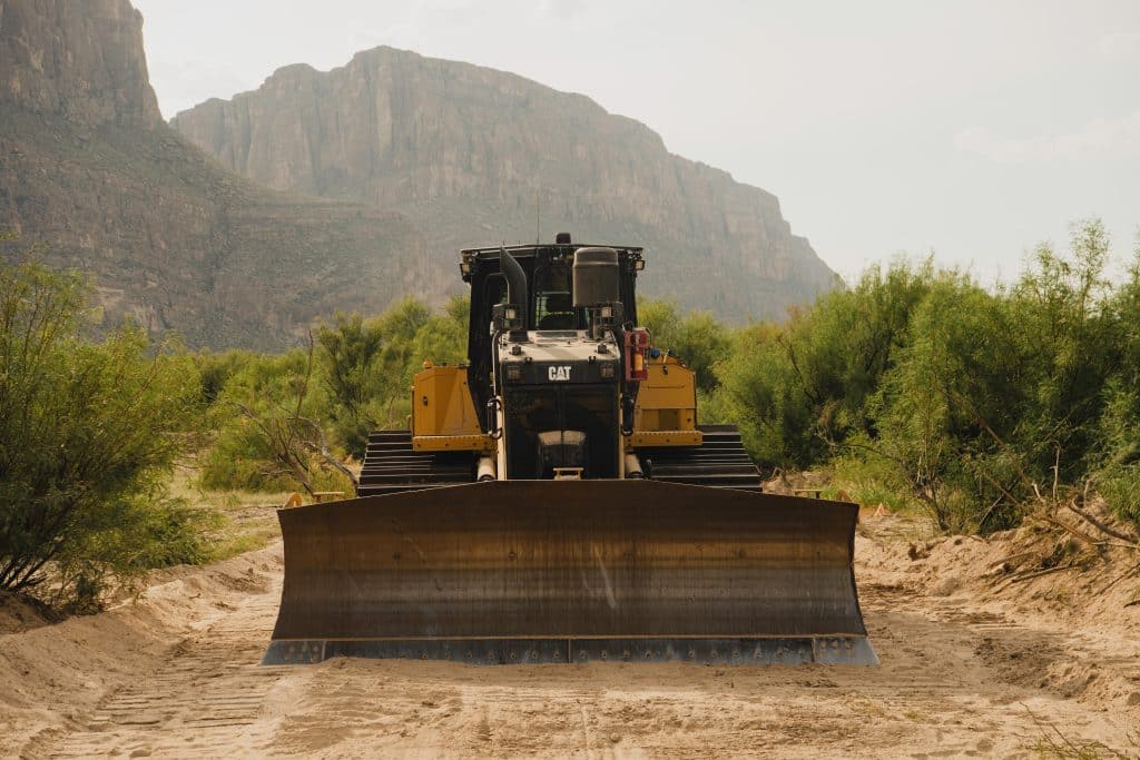
Bulldozers and earthmoving equipment descended on Big Bend National Park in August, tearing into the earth near Boquillas Canyon to the east and Santa Elena Canyon to the west. Last year, Congress gave the Trump administration $46.5 billion to build hundreds of miles of border walls, and contractors are rushing to erect them from the California coast to the tip of Texas. Now, Big Bend is in Trump’s crosshairs.
Based on the destruction already visited on the Arizona borderlands, it’s easy to predict what’s coming to the national park.
After locals filmed bulldozers carving through mile after mile in Big Bend, Customs and Border Protection (CBP) commissioner Rodney Scott claimed that “what people are seeing right now is survey and design work—NOT construction of a wall through the park.” The New York Times subsequently reviewed satellite images showing that the swath of destruction followed the lines on CBP’s so-called Smart Wall map and was far more extensive than needed for surveys. Either Scott did not know what CBP’s contractors were doing, or he was lying.
A week later, Scott posted a video of himself walking through an airport, saying, “CBP is pausing all construction activity in Big Bend National Park while I visit and conduct a personal, on-the-ground evaluation.” On September 29, CBP announced that the pause had ended. While bulldozing has not resumed (at least within the park—along the rest of the border, there was never a reprieve), CBP has remained silent on what changes, if any, have been decided on.
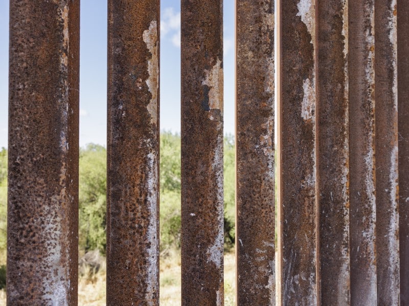
The agency’s website describes two types of barriers that will cut across the Big Bend region: vehicle barriers, which in the past tended to be four-to-six-foot-tall posts spaced four feet apart, meant to block a truck barreling across open lands; and bollard border walls, consisting of six-inch-wide steel posts spaced four inches apart that stand 30 feet tall.
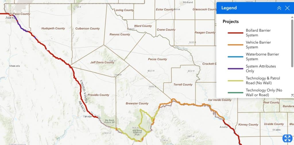
CBP has already awarded five contracts in the Border Patrol’s Big Bend Sector. One contract, Big Bend 5, will run a vehicle barrier and patrol road for 165 miles from Lake Amistad west through Seminole Canyon State Park and across the Pecos River to just shy of Big Bend National Park. That contract was awarded to Fisher Sand & Gravel and is worth $2.5 billion. Another, Big Bend 4, awarded to Southwest Valley Constructors (a subsidiary of Kiewit) for $1.7 billion, picks up from there, extending west through the park. The current claim is that it will pay for 17 miles of vehicle barrier in the park, along with many more miles of patrol road and detection technology. The other three contracts—Big Bend 1, 2, and 3—extend 30-foot-tall bollard border walls upriver for 165 miles, starting at the western boundary of Big Bend Ranch State Park. The first bollard panels of Big Bend 1 were installed on September 15.
Commissioner Scott’s duplicity, coupled with unannounced changes to CBP’s online map, makes it difficult to pin down CBP’s real intentions in the Big Bend region and what impacts will be felt on the ground. CBP’s actions in Arizona, however, show what may eventually hit the Big Bend region: the construction of vehicle barriers that inflict severe ecological damage and are inevitably turned into bollard border walls.
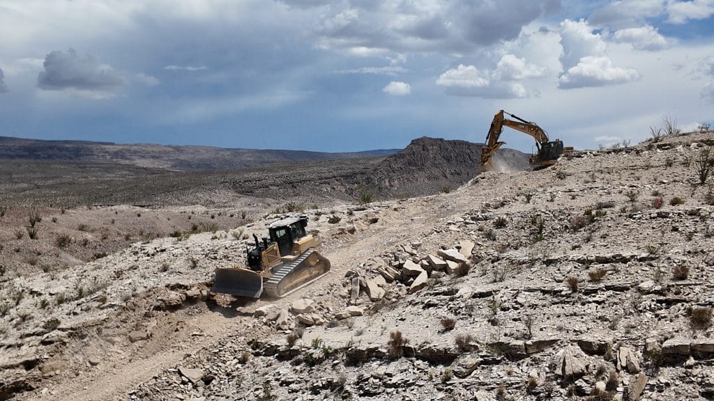
The San Bernardino National Wildlife Refuge sits near the southeast corner of Arizona, abutting the U.S.-Mexico line. Much like the Big Bend region, it has never seen many border crossings because much of the terrain is riven with eroded fissures that prevent most vehicles from getting through. Annual monsoons bring flash floods to those drainages, and during the dry parts of the year, springs feed wetlands and ponds, like Black Draw and Hay Hollow Wash, which provide habitat for fish listed under the Endangered Species Act.
Although vehicles rarely traverse San Bernardino, the George W. Bush administration decided in 2008 to run a patrol road and vehicle barrier along its southern boundary. It was a disaster from the start. Granite Construction bulldozed an archaeological site to create a storage yard for equipment and materials. They dumped earth and stone into Hay Hollow Wash and Black Draw to create a patrol road, burying the aquatic habitat of endangered species.
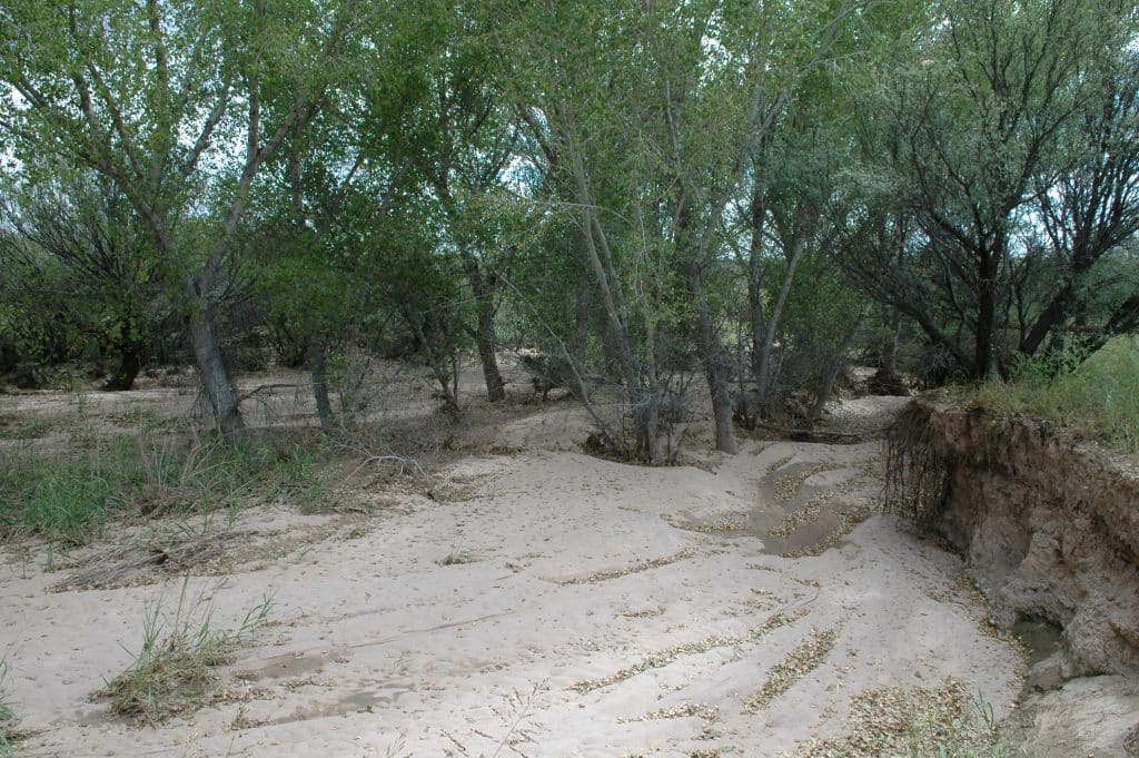
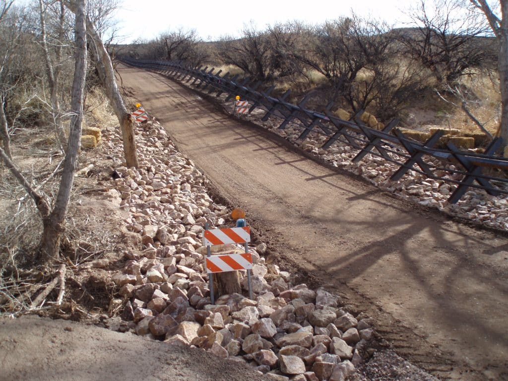
It proved counterproductive to install a graded road where the terrain had previously prevented most vehicle incursions. The refuge’s annual report for fiscal year 2008 stated that “within three days of completion of the project in the San Bernardino valley, drug smugglers began cutting portions of the Normandy barrier … to allow vehicles loaded with marijuana to drive into the United States using the new system of all-weather roads constructed by DHS. Drive-through loads have subsequently increased in the San Bernardino valley.”
Building on that failure, the Trump administration moved in 2019 to replace San Bernardino’s vehicle barriers with 30-foot-tall bollard border walls. To avoid hauling water to the remote job site, Southwest Valley Constructors drilled a series of wells tapping the same aquifer that fed ponds in the refuge that sheltered endangered species. According to a March 2020 U.S. Fish and Wildlife memo, in just a few months, the water pressure that drove artesian springs plummeted. In eight ponds, water depth lowered significantly, while three others went completely dry, forcing refuge staff to “salvage” endangered fish.
When the four-to-six-foot-tall vehicle barriers were replaced with 30-foot-tall border walls, whose vertical bollards had only four-inch-wide gaps between them, they blocked the movement of many terrestrial animals. To document the impact on wildlife, biologists working for the Sky Island Alliance and the Wildlands Network set up motion-triggered cameras near the newly erected walls at San Bernardino and at remaining vehicle barriers farther west. As one might expect, larger animals—bears, mountain lions, and deer in particular, which previously had no difficulty getting through vehicle barriers—were stopped cold by bollard walls. Overall, they found that terrestrial animals encountering a bollard border wall were 86 percent less likely to make it to the other side than wildlife that were confronted with a vehicle barrier.
Border walls had a similar effect on moving water. Clear running water can pass between bollards, but with 60 percent of the area filled with steel, it backs up. Of course, desert flash floods do not run clear; they carry loads of debris and sediment that pile up against obstructions—bollards, for example—clogging the spaces between them and turning border walls into dams. This has happened repeatedly as walls have gone up along the Arizona border, in some instances causing them to topple and wash away. So when vehicle barriers were turned into bollard walls in San Bernardino, hinged floodgates were installed that, in theory, could be opened to let debris-laden waters pass. During the summer monsoon floods of 2021, newly built gates proved inadequate to that task and were torn off their hinges.
CBP is now poised to add a second layer of 30-foot-tall bollard walls parallel to those built through San Bernardino during Trump’s first term. Dozens of laws have been waived, contracts have been awarded, and construction equipment is once again being staged near the refuge. Border-wide, 578 miles of existing border wall will get a “secondary border wall.” If vehicle barriers were effective, there should be no reason to convert them to 30-foot border walls. If border walls were effective, there should be no reason to erect a second wall. But that step-by-step replacement and addition has become, in the eyes of the Trump administration, the only way forward.
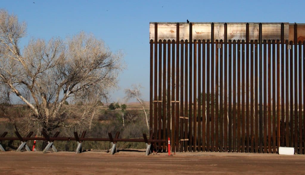
With that in mind, Trump is dead set on transforming all remaining vehicle barriers into 30-foot-tall bollard border walls. When George W. Bush left office, he left behind 299 miles of 18-foot-tall border wall and 248 miles of vehicle barrier. When Trump moved out of the White House after his 2020 election defeat, he had replaced 142 miles of those vehicle barriers with 30-foot-tall bollard border walls. Now Trump is directing CBP to convert the rest.
That includes the 62 miles of vehicle barrier that the Bush administration built through the Tohono O’odham Nation, whose reservation is in what is now Arizona but whose traditional lands encompass portions of both the United States and Mexico. In June, over the Nation’s objections, CBP awarded a contract to convert those barriers into 30-foot-tall bollard walls. The Nation had reason to be concerned: in April, construction crews working on a second layer of border wall outside the reservation bulldozed a line across the Las Playas Intaglio, a 200-foot-long geoglyph that was drawn on the desert floor more than 6,500 years ago and that holds deep religious significance for the O’odham. With protective laws waived and billions of dollars to spend, the Trump administration was unlikely to take steps to avoid further desecrations.
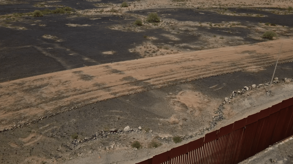
The Tohono O’odham Nation sued the Trump administration, alleging that the new construction would illegally infringe on reservation lands and sovereignty. Tribal police were instructed to cite construction crews if they trespassed on tribal lands. On August 14, Judge Richard Leon denied their request for a restraining order, stating that “I find that the government’s interests in securing the border, enforcing immigration laws, and ensuring public safety outweigh any surviving irreparable harms” that wall construction might inflict. Leon’s ruling ended with the admonition that “while I have concluded that a preliminary injunction is unwarranted, I fully expect the government in the months ahead to follow through on its guarantees of consultation with the Nation to address the Nation’s concerns regarding border wall construction!”
Ignoring the judge’s words, a week and a half later, 20 armed and masked CBP agents, including members of the agency’s BORTAC SWAT team, escorted contractors onto the reservation so that they could make preparations for border wall construction. CBP established a blockade to prevent tribal police from reaching the worksite to remove the contractors. It is unclear how soon heavy equipment will move in and border wall construction will begin, but it is imminent.
This is the dynamic that the Big Bend region can expect. Compromise, such as accepting vehicle barriers and patrol roads in the hope that nothing more will be built, is not a real option.
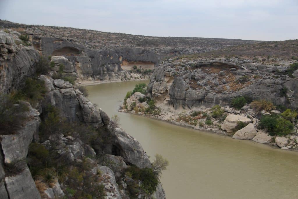
Spending billions of dollars on border walls that have a long track record of failure makes no sense. Building vehicle barriers through the Big Bend region makes even less sense. These are places where almost no one crosses the border, according to CBP’s own apprehension numbers, and it is beyond absurd to perch vehicle barriers above high canyon walls that a wheeled vehicle cannot climb.
Big Bend National Park is named for and anchored by the deep southward bend in the Rio Grande that carves the canyons of Santa Elena, Mariscal, and Boquillas. Santa Elena’s walls rise 1,500 feet above the river, and Mariscal and Boquillas canyons nearly match its depth. In the Chihuahuan Desert, the stretches of river between them provide access to water, which is critical for animal communities. Carving roads and installing barriers there will not stop anyone but will destroy precious riparian habitat and block animal movement.
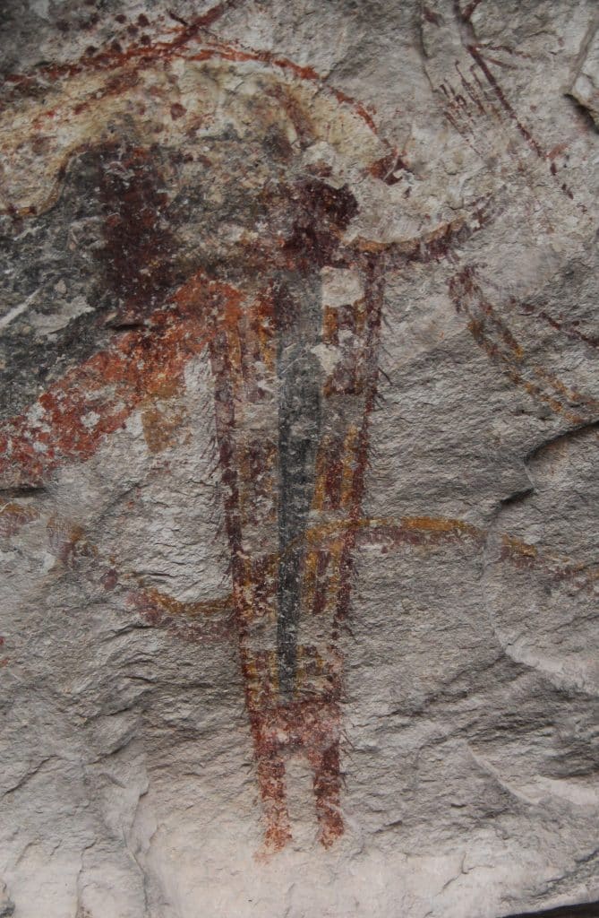
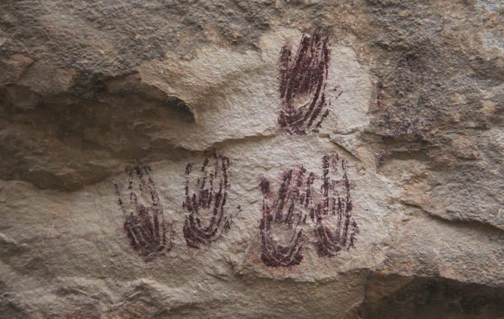
Like Tohono O’odham land, Seminole Canyon State Park and the wider Pecos River region are home to stunning Native American pictograph panels painted on canyon walls 1,000 to 5,700 years ago. Vehicle barriers and a patrol road will cut across Seminole Canyon near the Panther Cave pictograph panel and cross the Pecos River canyon within sight of the White Shaman pictographs. In this landscape of chasms hundreds of feet deep, it is impossible to drive across the border. Archaeologists focused on the region say at least 80 archaeological sites lie south of the useless barriers, and construction could damage them significantly. Blasting may shake rock faces loose, for example, taking ancient artworks down with them.
Commissioner Scott’s claim that he visited Big Bend to evaluate a situation that he was somehow unfamiliar with is disingenuous, to put it politely. Scott joined the Border Patrol in 1992, so he saw the installation, and failure, of vehicle barriers in San Bernardino in 2008. Scott was the Border Patrol’s national chief in 2020, when those barriers were replaced with 30-foot-tall border walls. As CBP commissioner, Scott is now overseeing the construction of a second layer of wall through San Bernardino and the assault on the Tohono O’odham Nation to facilitate the conversion of vehicle barriers to border walls. Scott knows full well that roads and barriers in the Big Bend region, like those through San Bernardino and the Tohono O’odham Nation, will prove both useless and destructive, but he intends to follow Trump’s orders and build them anyway.
Scott’s Big Bend junket and the temporary pause in construction are nothing more than attempts to defuse vocal and effective opposition ahead of the midterms. Once the election is over, the bulldozing will almost certainly resume.
The scars already carved across Big Bend, for what Scott claims are just “survey and design work,” are irreparable. CBP may install vehicle barriers across the region in the coming months, causing significantly worse harm, but that will not be the end. Vehicle barriers have always been temporary. When, as is likely, they are replaced with 30-foot-tall border walls and, eventually, a second border wall layer, Big Bend National Park, Seminole Canyon State Park, and the stretch of the Rio Grande between them will be devastated. It will be impossible to restore those sacred landscapes and the art they contain.
Comments (1)
Leave a comment
Related Articles
American Rust: The $1.1 Billion Border Wall Built with Salvaged Materials and Few Answers
A newly constructed wall built with old, salvaged material in South Texas is probably illegal; it’s also costing twice as much as previous walls. What are taxpayers paying for, exactly?
“We See No Border”: The Tohono O’odham Fight Against the Border Wall
The irreparable harm that has already been done, says tribal chairman Verlon Jose, you can feel it, hear it, in the people.
Swarm Intelligence: A Reporter’s Notebook on the Freedom of Movement in the Maasai Borderlands
Could solutions to climate woes such as drought be found in the freedom of mobility? This on-the-ground report from the Kenya-Tanzania border examines that question and more.

It saddens me to see the destruction occurring in our country.