Introducing the Wall Watch Project and Contractor Database
Explore the companies, contracts, and construction projects reshaping the U.S.–Mexico border—and get ready for a new series of Wall Watch Dispatches.
By Dugan Meyer
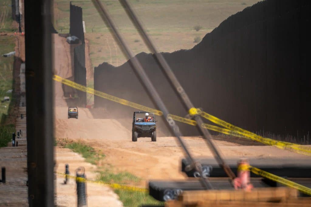
Billions of dollars of new border walls, buoy barriers, surveillance systems, patrol roads, and other enforcement infrastructure are currently underway throughout the U.S.–Mexico borderlands. Yet finding reliable, detailed information about where this work is happening, what it entails, and which companies are carrying it out remains surprisingly difficult.
That’s why The Border Chronicle recently launched Wall Watch. This community-powered mapping project brings together official government records, borderlands journalism, and on-the-ground community reports to document the scope of this border infrastructure build-out and its impacts.
Now, we’re expanding Wall Watch with the launch of the Wall Watch Border Barrier Project and Contractor Database, a searchable resource designed to make information about ongoing border barrier projects—and the companies profiting from their construction—even more accessible to the public.
Going Beyond the Government’s Border Wall Map
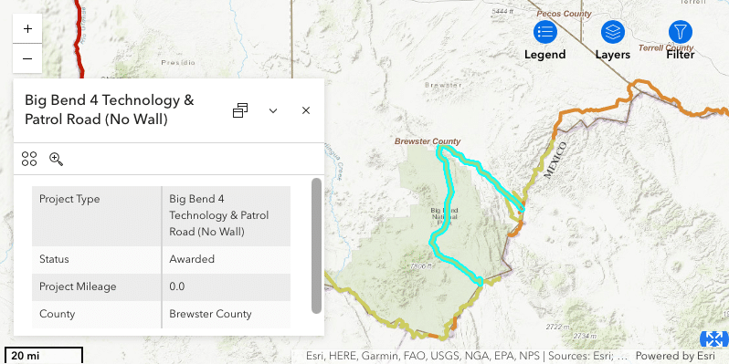
U.S. Customs and Border Protection (CBP) maintains a publicly accessible “Smart Wall” map identifying current border barrier projects. But while the CBP map provides a useful starting point, it offers only a limited—and, in some cases, downright inaccurate—picture of the work underway.
Viewers of the CBP map can click on project segments to see a handful of information fields about each project, such as its name, project type, status, mileage, and county. But information types are often mislabeled or combined, project mileage figures are often inaccurate, and information about construction contracts, funding, legal waivers, and more is simply nonexistent. It’s possible to access the map’s underlying dataset via an ArcGIS REST server, and it includes additional information like project name and type details. Still, the consistency and accuracy of this data are equally dubious.
Wall Watch builds on the CBP dataset and Department of Defense information not included on the Smart Wall map, cleaning and organizing the data while supplementing it with additional research and documentation.
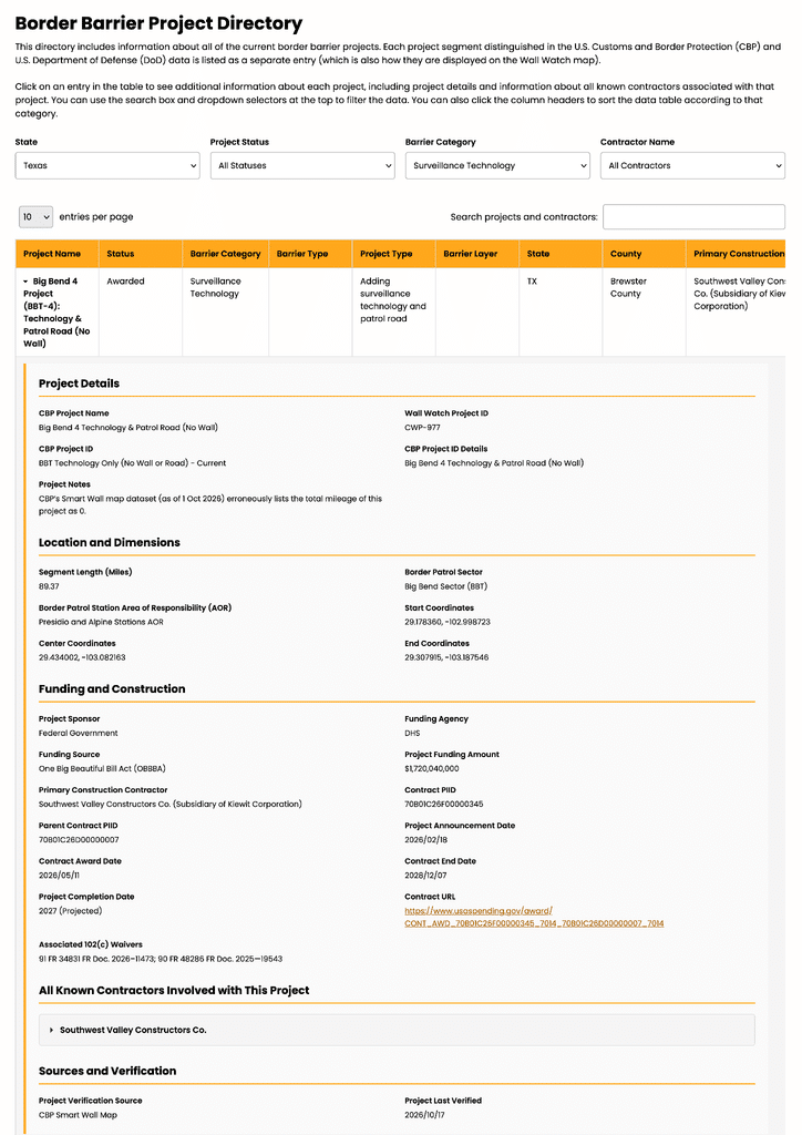
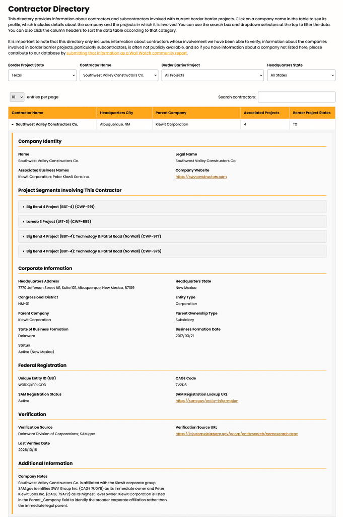
For example, Wall Watch helps users identify construction contracts associated with individual projects, the companies involved as primary contractors and subcontractors, and federal waivers issued under Section 102(c) of the REAL ID Act that allow certain border barrier projects to proceed without complying with numerous environmental and other legal requirements. We also provide accurate mileage measurements calculated directly from the project geometry instead of relying on CBP’s often inaccurate figures. Users can also follow links from the Wall Watch map to federal contract records on USAspending.gov, official waiver announcements, and other supporting sources.
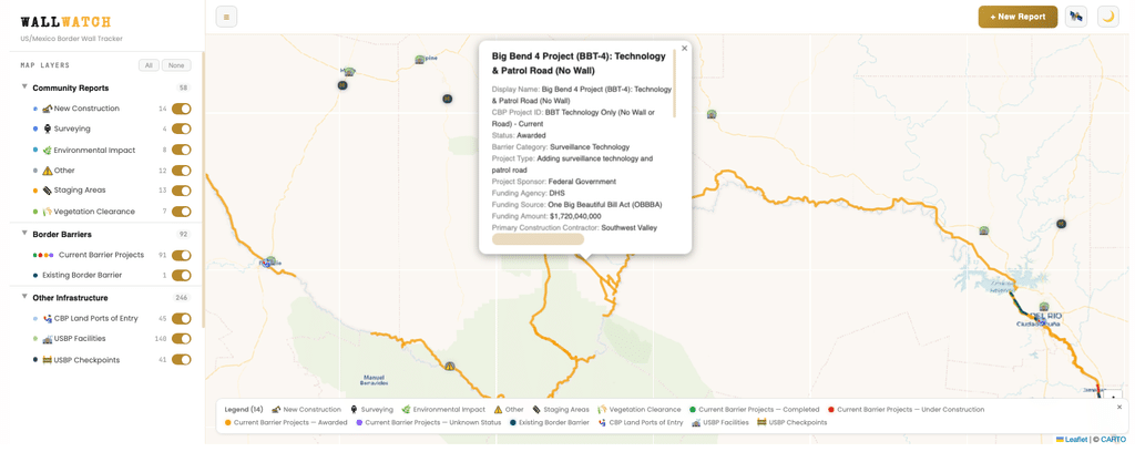
The new Border Barrier Project and Contractor Database makes this information even easier to explore. Users can interact with the database through two searchable directories on the Wall Watch page, the Border Barrier Project Directory and the Contractor Directory. These tools allow users to filter projects by location, project type, contractor, and other attributes, making it possible to investigate construction activity across the borderlands or focus on a particular community, project, or company.
Connecting the Dots Across the Borderlands
The interactive Wall Watch map complements the Border Barrier Project and Contractor Database by placing individual construction projects within a broader landscape of border enforcement infrastructure.
Alongside current projects and existing border barriers, users can explore the locations of Border Patrol facilities and checkpoints, surveillance technology documented by the Electronic Frontier Foundation, and other infrastructure. An upcoming layer will also document the National Defense Areas recently established along the border.
But official records tell only part of the story.
Through our Community Reports tool, people living in, working in, and visiting the borderlands can share observations about construction activity, equipment staging areas, vegetation clearance and other environmental impacts, community resistance, and other developments that may never appear in government records or news coverage.
Together, these resources connect federal contracts and project announcements with the physical transformations taking place on the ground—and the experiences of communities affected by them.
Coming Soon: Wall Watch Dispatches
To help readers make sense of these developments, The Border Chronicle is also launching Wall Watch Dispatches, a new series of twice-monthly snapshots highlighting specific places and projects along the U.S.–Mexico border.
Each dispatch will zoom in on a particular area from the Wall Watch project, drawing on Community Reports, government documentation, and our supplementary research to examine what is happening in more detail, including who is involved and what these changes might mean for the surrounding landscape and communities.
These dispatches will also offer opportunities to explore the underlying information through Wall Watch and contribute new observations that can deepen our collective understanding of border militarization.
Explore the Wall Watch map and the new Project and Contractor Database, and subscribe to The Border Chronicle’s newsletter to receive upcoming Wall Watch Dispatches. Our work depends on our paid subscribers and members. You can help support Wall Watch and our other public tools and independent investigative work today by becoming a Founding Member for $15 a month or $175 a year, or a Sustaining Member for $25 a month or $250 a year. Or send a one-time donation. All of your contributions are tax-deductible.
And if you’ve observed border barrier construction, environmental impacts, new surveillance technology installation, or other relevant activity, submit a Community Report to Wall Watch. Your observations can help document developments that government records and news coverage overlook.
Author

Related Articles
Before the Wall: The Last Stand at Lochiel
As a double border wall rises through Lochiel, protesters gather to defend the ancient cottonwoods and the San Rafael Valley.
Border Patrol Deploys Tactical Unit Against Protesters Blocking Arizona Border Wall
“I said, with due respect, sir, they are standing here with pepper spray artillery and gas masks on. They are not talking to us; they are assaulting us.”
Border Walls Devastating Arizona Are a Warning for Seminole Canyon and Big Bend
Vehicle barriers are just the first step in the march to 30-foot border walls. San Bernardino National Wildlife Refuge is seeing the brutal endpoint.

Comments (0)
There are no comments on this article.